posters & Chart maps |
|
|
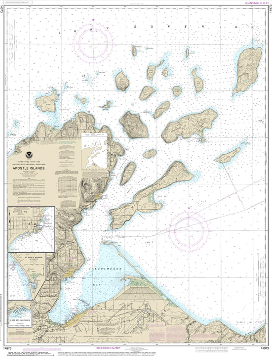
NOAA NAUTICAL CHART 14973
Apostle Islands, including Chequamegan Bay; Bayfield Harbor; Pikes Bay Harbor; La Pointe Harbor. Printed on water resistant paper and SHIPPED rolled. NOAA is sunsetting paper charts so the chart you are viewing is NOT updated weekly and does not include all of the latest Notice to Mariners corrections. Edition # 28, Size 36" x 50" $28.00 |
|
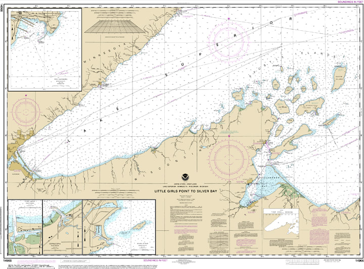
NOAA NAUTICAL CHART 14966
Little Girls Point to Silver Bay, including Duluth and Apostle Islands;Cornucopia Harbor;Port Wing Harbor;Knife River Harbor;Two Harbors. Printed on water resistant paper and SHIPPED rolled. NOAA is sunsetting paper charts so the chart you are viewing is NOT updated weekly and does not include all of the latest Notice to Mariners corrections. Edition # 28, Size 36" x 50" $28.00 |
|
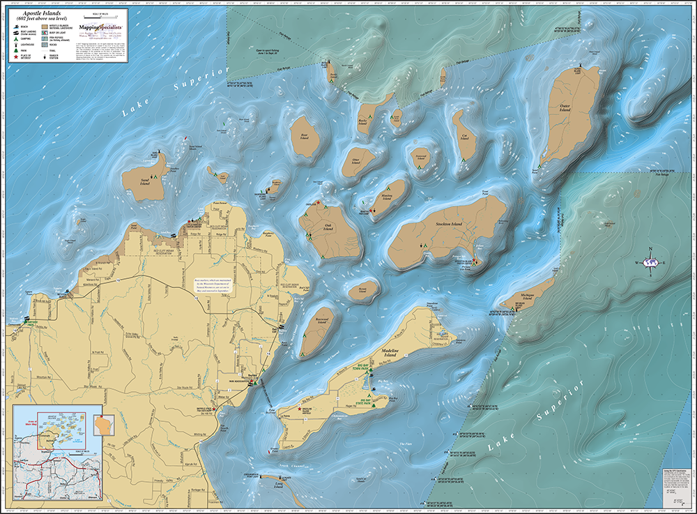
APOSTLE ISLANDS MAP
Our Apostle Islands map displays a relief model that allows the user to view the lake in 3-D, and GPS coordinates are provided for navigation. Symbols showing beaches, boat landings, lighthouses, buoys, camping areas and places of interest give the map an eye-catching appeal. 36" x 27", ships rolled. $26.00 |
|
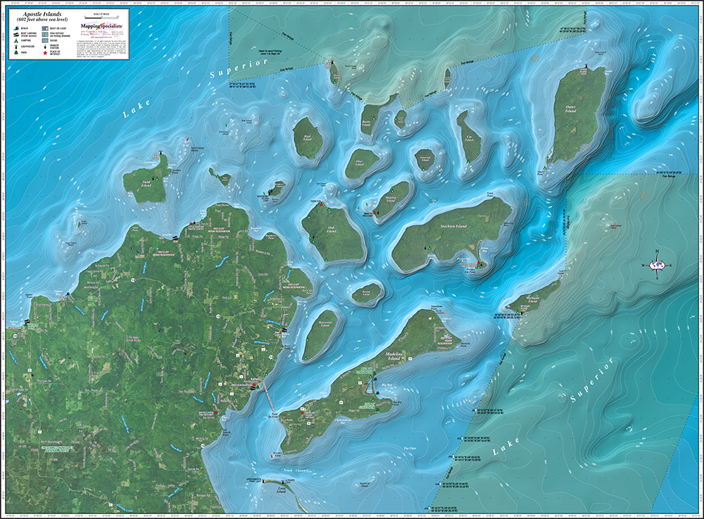
APOSTLE ISLANDS ENHANCED MAP
Our enhanced wall map of the Apostle Islands displays aerial photography and includes symbols showing beaches, boat landings, lighthouses, buoys, camping areas and places of interest. The maps contain GPS coordinates for easy navigation. “Enhanced” maps have aerial photography overlaid on the land. 36" x 27", ships rolled. $32.00 |
|
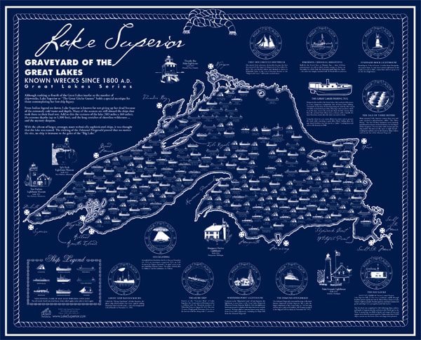
LAKE SUPERIOR SHIPWRECK POSTER
This is a fascinating and historically accurate shipwreck poster of Lake Superior. A double ink printing technique is used to create the dark navy blue on cream paper resulting in a stunning, rich effect. For anyone interested in shipwrecks, this map offers the very best information regarding when, where and what. “Portholes of History” give you insight, facts and figures. 24" x 30", ships rolled. $19.95 |
|
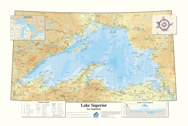
LAKE SUPERIOR MAP
This is a very informative and attractive map of Lake Superior! It shows towns, lighthouses, parks, many shipwrecks, major highways, depths, inland lakes and much more. It's a standard size for framing, 36" x 24", and printed on distinctive paper. Ships rolled. This is not a navigational chart. $15.95 |
|
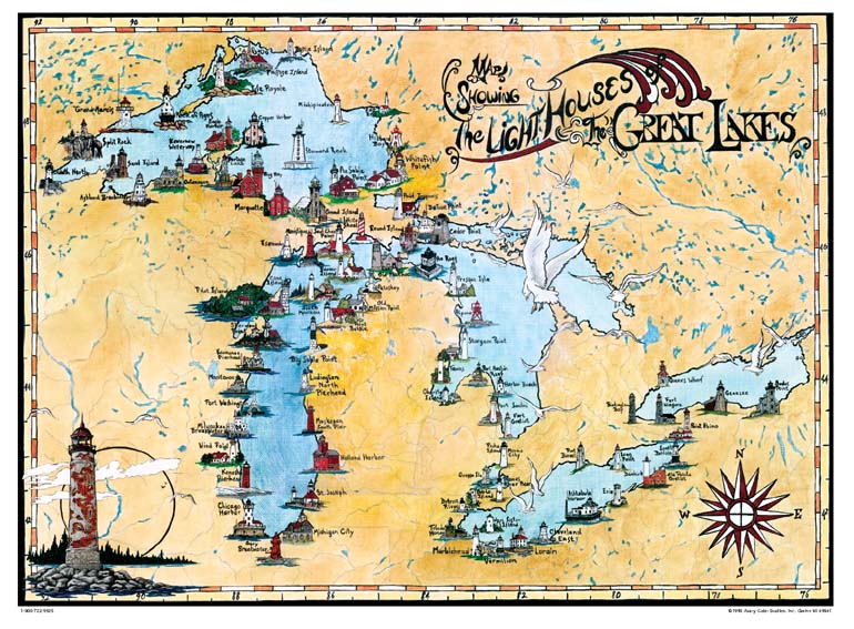
GREAT LAKES LIGHTHOUSE MAP
This attractive full color map features over 80 of the region’s historic lighthouses. It's printed on high- quality acid-free paper and is sized ready for framing at 24” x 18”. Ships rolled. $14.95 |
|
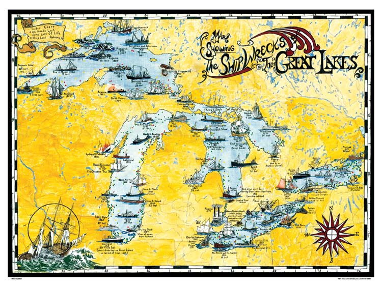
GREAT LAKES SHIPWRECK MAP
This attractive full color map shows nearly 70 historic shipwrecks and notes the locations of dozens of others. It's printed on high- quality acid-free paper and is sized ready for framing at 24” x 18”. Ships rolled. $14.95 |
|
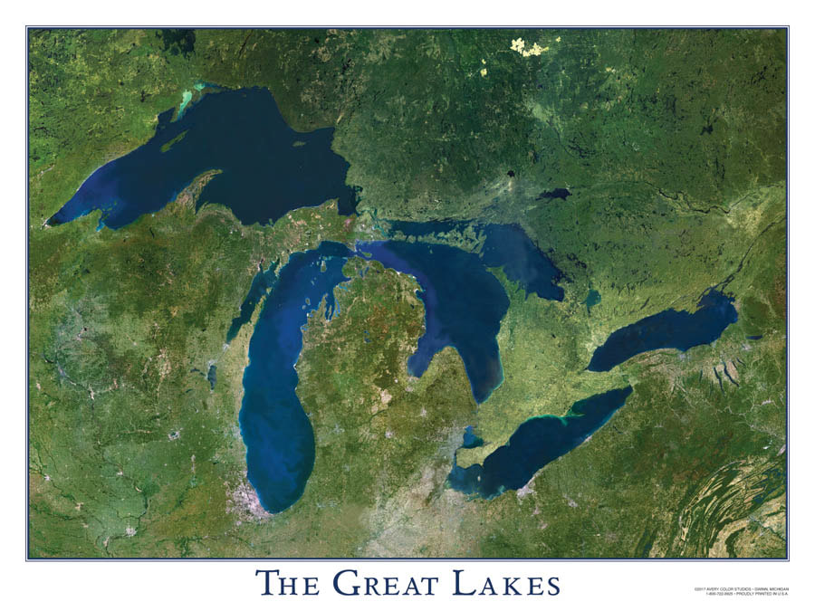
GREAT LAKES SATELLITE IMAGE
Stunning satellite image of the entire Great Lakes. Perfect for any home or office decor. Full color, printed on 24” x 18” high-quality, acid-free paper. Ships rolled. $14.95 |
|
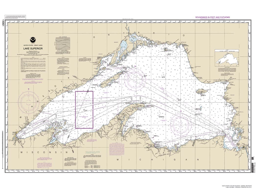
LAKE SUPERIOR NOAA CHART
An exact reproduction of NOAA Lake Superior Chart. Perfect for any home or office decor. Not to be used for navigation. Full color, printed on 24” x 18” high-quality, acid-free paper. Ships rolled. $14.95 |